Geospatial Data – Unlocking the Unseen
“You can’t use an old map to explore a new world.”
These words hold as much literal and figurative truth today as they did when uttered by Albert Einstein years ago. For several years, Nigeria’s immunization professionals relied on hand-drawn maps built using local knowledge to navigate their localities as well as plan and offer immunization services. Human error made these maps prone to inaccuracies due to the use of imprecise scales as well as inadequate demographic and geospatial data. This ultimately resulted in many settlements being missed during immunization outreach services; however, all this is changing.
At a Glance
Since 2018, the Geo-Referenced Infrastructure and Demographic Data for Development, or GRID3, has supported the Federal Government of Nigeria in its drive to use more accurate geospatial data and replace hand-drawn maps with digital solutions.
GRID3 works with countries to generate, validate and use geospatial data to understand and respond to pressing problems. The organization provides a unique package of tools with which to generate open-source data, support for data applications to ensure effective impact and training to strengthen the national geospatial foundation for data-based decision-making.
The first major evidence of the effectiveness of GRID3’s use of geospatial data for health interventions in Nigeria was recorded on June 21, 2020 when through the use of geospatial data, the country was certified as polio-free, an achievement enabled, in part, by innovative geospatial technologies.
Mapping the Rollout of COVID-19 Vaccines
The novel coronavirus has tested the resilience of health systems globally, and the losses suffered by humanity during this pandemic have been unimaginable. The global rollout of COVID-19 vaccines in 2020 brought a glimmer of hope to a bleak situation, but effective distribution has proved to be a challenge.
In Nigeria, the first shipment of four million doses of the Oxford-AstraZeneca vaccine was expected in the first quarter of 2021. The arrival of these vaccines was timely, given the threefold rise in the number of COVID-19 infections across Nigeria in early 2021.
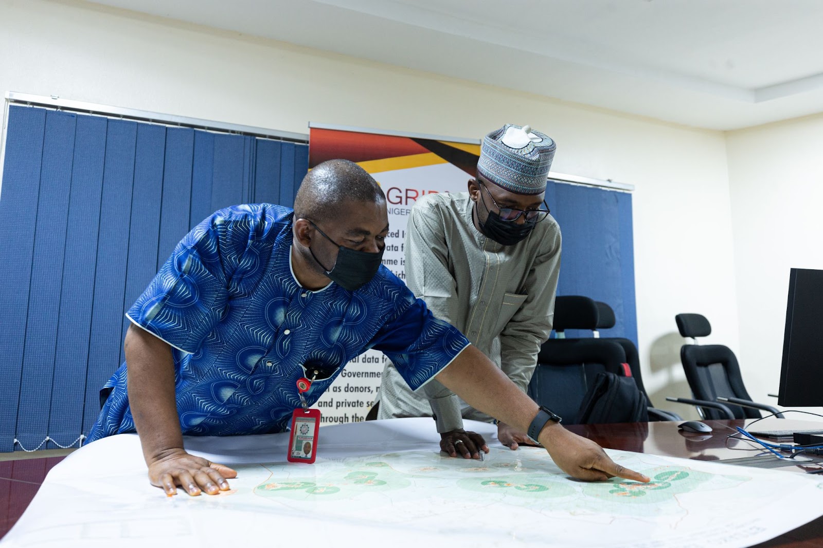
GRID3’s Nigeria Country Manager, Nazir Halliru, was keen on using his organization’s technology to mitigate the spread of COVID-19 by getting vaccines to eligible populations as fast as possible. Nazir and his team created maps that covered the 774 local government areas (LGAs) that make up the administrative tier of the country, below state and federal government levels. Printed versions were distributed to the states through a parastatal of Nigeria’s Federal Ministry of Health, known as the National Primary Health Care Development Agency (NPHCDA).
The maps displayed the locations of vaccination sites and surrounding two-, five- and ten-kilometer areas, locations of other healthcare facilities and infrastructure (e.g., schools, prisons, and internally displaced person’s camp survey points), settlement names, as well as gridded population estimates. They also included tables summarizing total population of each ward (Nigeria’s smallest administrative unit), population aged 50 years or older, as well as estimated comorbidity risks per ward.
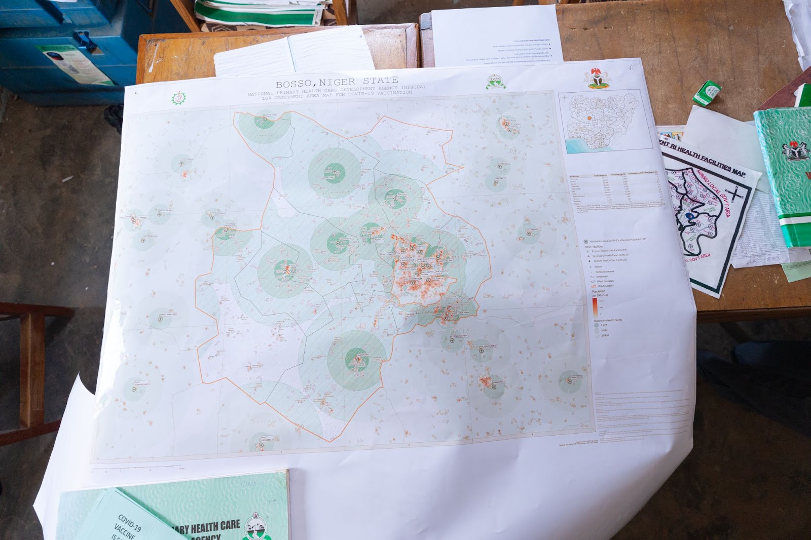
Sample of GRID3 COVAX Map for the Local Government of Kaltungo, Gombe State
Nazir’s hope was that with the whole nation mapped, equitable access to COVID-19 vaccines could be achieved as health workers and vulnerable populations could be easily targeted.
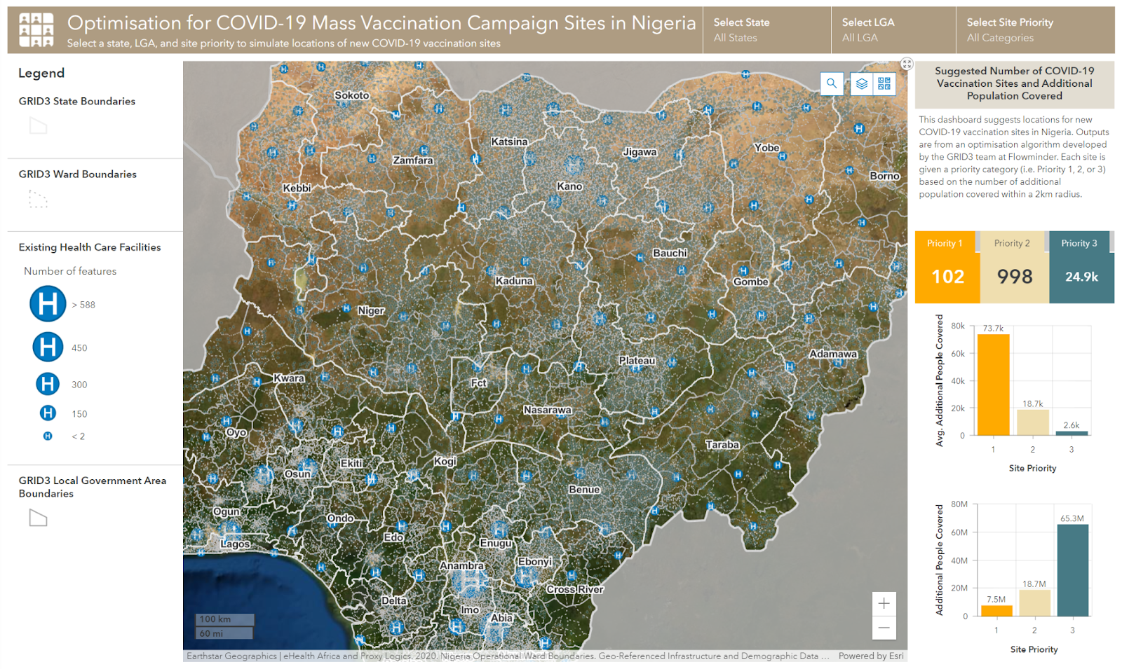
Working with Nigerian government stakeholders to optimize site placements for COVID-19 vaccination centers across the country, Nazir currently works with the GRID3 partners to create a dashboard for health workers to digitally plan their services. In line with the country’s massive vaccination campaign strategy, the dashboard suggests placements of additional vaccination sites based on the number of additional populations that could be covered within a two-kilometer radius. So far, this data has proved to be invaluable to immunization professionals as they endeavor to ensure that vaccines are reaching people across the country. With the optimized site placements, populations targeted during the vaccine rollout are easier to access and monitor.
Using Maps to Combat Misinformation
As with many other nations, getting Nigeria’s COVID-19 vaccination campaign off the ground proved to be difficult because of widespread misinformation that bred vaccine hesitancy. As a member of the National Technical Working Group for COVID-19 vaccinations, Nazir was aware of the dampening effect of vaccine hesitancy. This was not his first time dealing with COVID-19 misinformation, having had to work through that challenge in the months following the onset of the pandemic.
To combat this situation in late 2020, Nazir and the GRID3 team supported the Nigerian government, through the Presidential Task Force on COVID-19, to deploy communication risk layers created by Fraym to inform and disseminate targeted communication campaigns and social mobilization activities. The population estimates were disaggregated at the ward level to determine high-risk groups and determine which news outlets appealed to specific groups, and this information was then used to determine the best platforms to reach them.
The solid foundation that Nazir and the GRID3 team built proved to be extremely useful in accelerating vaccination efforts. The risk communication campaign that was developed to address vaccine hesitancy relied on the initial data to create impactful strategies. Social media messages, town hall meetings led by community heads and even testimonials from those who had been vaccinated became the tools in the trenches of achieving vaccination targets.
Geospatial data provided by GRID3 has optimized a wide range of vaccination strategies and services, from informing micro-planning and human resource allocation, to getting vaccines to otherwise unmapped populations. The micro-planning process ensures that nobody is left behind in the fight against COVID-19 and other vaccine-preventable diseases.

Submitter Bio
This Bright Spot story was submitted by Roqeebah Olaoniye, Communication Specialist at GRID3. As the world continues to grapple with the effects of the COVID-19 pandemic on populations, we at GRID3 are keen to share the power of geospatial insights and technologies to improve response strategies informed by the most up-to-date datasets. This story specifically showcases the Federal Government of Nigeria’s commitment to mitigating the effects of the virus through timely and effective last-mile delivery of COVID-19 vaccines enhanced by GRID3’s geospatial insights and solutions.